Methods
This page describes the methods used for WorldClim version 1.
For a complete description, see:
Hijmans, R.J., S.E. Cameron, J.L. Parra, P.G. Jones and A. Jarvis, 2005. Very high resolution interpolated climate surfaces for global land areas. International Journal of Climatology 25: 1965-1978.
The data layers were generated through interpolation of average monthly climate data from weather stations on a 30 arc-second resolution grid (often referred to as "1 km2" resolution). Variables included are monthly total precipitation, and monthly mean, minimum and maximum temperature, and 19 derived bioclimatic variables.
The WorldClim interpolated climate layers were made using:
- Major climate databases compiled by the Global Historical Climatology Network (GHCN), the FAO, the WMO, the International Center for Tropical Agriculture (CIAT), R-HYdronet, and a number of additional minor databases for Australia, New Zealand, the Nordic European Countries, Ecuador, Peru, Bolivia, among others.
- The SRTM elevation database (aggregeated to 30 arc-seconds, "1 km")
- The ANUSPLIN software. ANUSPLIN is a program for interpolating noisy multi-variate data using thin plate smoothing splines. We used latitude, longitude, and elevation as independent variables.
For stations for which we had records for multiple years, we calculated averages for the 1960-90 period. We only used records for which there were at least 10 years of data. In some cases we extended the time period to the 1950-2000 period to include records from areas for which we had few recent records available (e.g., DR Congo) or predominantly recent records (e.g., Amazonia). We started with the data provided by GHCN, because of the high quality of that database. We then added additional stations from other database. Many of these additional databases had mean monthly values, without a specification of the time period. We added these records anyway, to obtain the best possible spatial representation, reasoning that in most cases these records will represent the 1950-2000 time period, and that insufficient capture of spatial variation is likely to be a larger source of error than in high resolution surfaces than than effects climatic change during the past 50 years. After removing stations with errors, our database consisted of precipitation records from 47,554 locations, mean temperature from 24,542 locations, and minimum and maximum temperature for 14,835 locations (see maps below).
A set of 'Bioclimatic variables' were derived from the monthly data. The maps below show the spatial distribution the climate stations for which we had data.
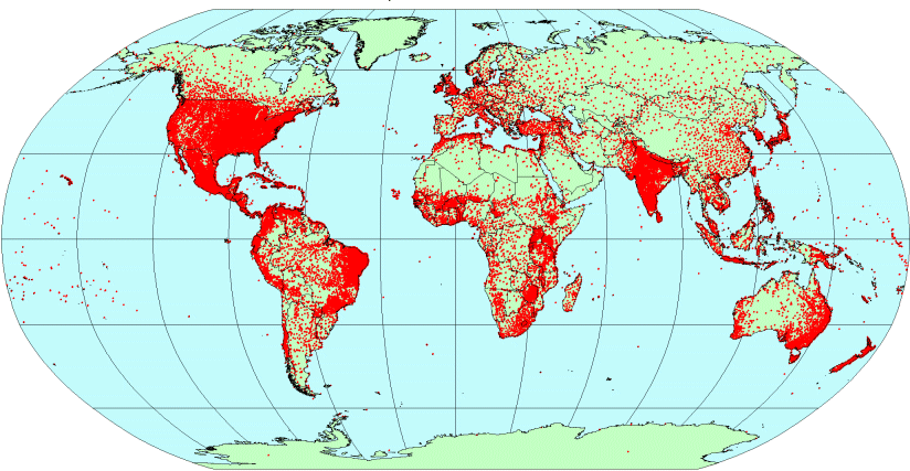
Figure 1. Locations of climate stations with precipitation data.
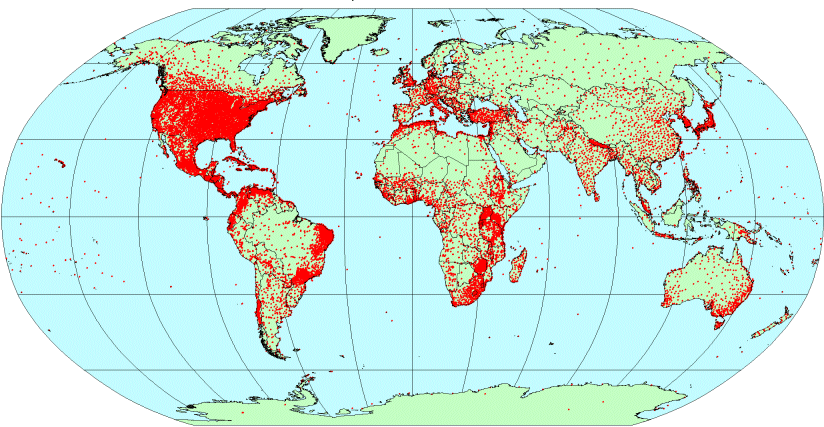
Figure 2. Locations of climate stations with mean temperature data.
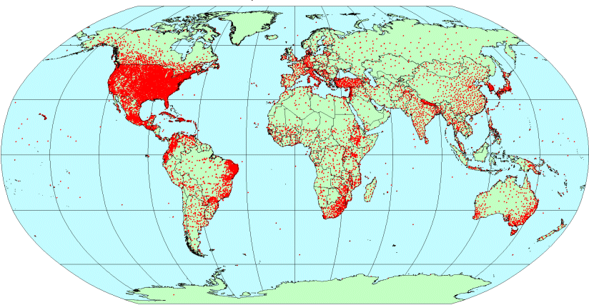
Figure 3. Locations of climate stations with temperature range data.